


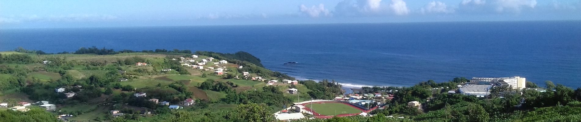
Boucle Morne Capot via Savane Cély

Lamartiniere
User GUIDE
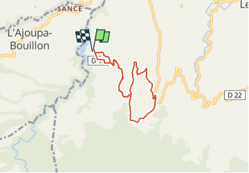

Length
9.4 km

Max alt
357 m

Uphill gradient
305 m
Km-Effort
13.4 km

Min alt
178 m

Downhill gradient
306 m
Boucle
Yes
Creation date :
2022-07-01 23:02:09.375
Updated on :
2022-07-01 23:13:14.428
3h03
Difficulty : Easy
3h03
Difficulty : Difficult

FREE GPS app for hiking
 SityTrail
IGN / Geographical institutes
SityTrail Plus
The world is yours!
About
Trail On foot of 9.4 km to be discovered at Martinique, Unknown, Le Lorrain. This trail is proposed by Lamartiniere.
Description
Les divers quartiers du secteur près le Morne Capot, Le Lorraion. Autorisation de traverser une bananeraie.
Photos

Positioning
Country:
France
Region :
Martinique
Department/Province :
Unknown
Municipality :
Le Lorrain
Location:
Unknown
Start:(Dec)
Start:(UTM)
704688 ; 1639423 (20P) N.
Comments